Showing posts sorted by date for query river trip. Sort by relevance Show all posts

Saturday, March 6, 2021

Exploring the Olympic Peninsula with Chris and Chelsea

When our son Chris and his partner Chelsea urged his restless parents to join them for winter camping and hiking on the Olympic Peninsula (OP), we practically shouted YES!, even though we'd be traveling north—into the rain. 

This has been the first winter in a half dozen that PK and I haven't fled Oregon's dismal damp by traveling south—into the sun. In recent years, we've been terribly spoiled exploring the American southwest and the Baja Peninsula in our van and then fulfilling lifelong dreams of exotic foreign travel adventures in both hemispheres.

Naturally, we've been peevish during the damn pandemic. A few quick get-aways did not remedy our high standing on the restlessness scale.

       Our guides enjoying a sweet sunrise at Lake Ozette.  
  
Chris and Chelsea live, temporarily, in their Airstream "home" close to Port Angeles, a small city on the edge of the Olympic rainshadow, where the average annual rainfall is just 26 inches. We enjoyed relatively benevolent weather as our enthusiastic guides showed off their new territory.

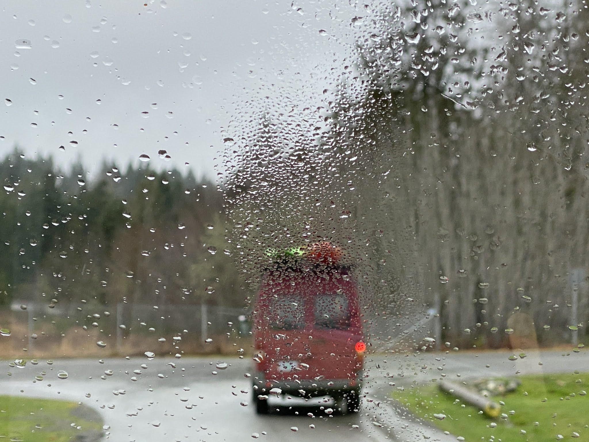
We saw this as we followed Chris and Chelsea in their Nevervan at the start of our tour. The weather improved in about a half-hour. 

Happy campers! The black trailer is a workspace and storage unit.
The Airstream is home-sweet-home.

Like everybody else, Chris' and Chelsea's lives were upended by the pandemic. This time of year, Chris would have been on, or planning, a kayaking expedition. Chelsea would be doubling down on her Ph.D. dissertation and preparing for another season as a cruise ship naturalist for Lindblad Expeditions-National Geographic  Instead, they migrated in the fall of 2020 to the OP from Washington's North Cascades before winter storms could hold captive the Airstream trailer they call home. 

Ramblers that they are, their intent was to stay for the winter and migrate elsewhere come spring. But it didn't take long before the OP cast a spell that has them discussing becoming first-time property owners. Their intention—and hope—is to settle near Port Angeles, the closest town to where they're now temporarily camped. 

Falling in love with the Olympic Peninsula (OP) is easy to understand. The 96-mile Strait of Juan de Fuca provides ocean perks and a gorgeous north-facing coastal strip where a handful of communities have developed.  On the south side of the coastal strip lies a great wilderness area—the  Olympic National Park. 

From the park's website:

Encompassing nearly a million acres, the park protects a vast wilderness, thousands of years of human history, and several distinctly different ecosystems, including glacier-capped mountains, old-growth temperate rain forests, and over 70 miles of wild coastline.

And kayaker Chris would add at least 19 wild rivers. With an abundance of mountains, rivers, lakes, and ocean beaches, outdoor adventures are practically unlimited. The national park alone has at least 52 trails comprising 611 trail miles. We barely scratched the surface.

If only we were younger....nevermind. 

Chris and Chelsea showed off some of their favorite places so far. Although they've only lived on the OP since October 2020, their explorations have been continuous. If you choose to visit the OP, you could do worse than follow their lead. 

SALT CREEK RECREATION AREA AND CRESCENT BAY - DO NOT MISS

A sweet sight from a coastal trail in the Salt Creek Area.


Atop the aerial photo, Crescent Bay has a private beach and is a separate entity from the official Salt Creek Recreation Area and Campground. The campsites visible accommodate large RVs requiring hook-ups. However, the wooded area between the RV camp and the bay includes some of the most desirable campsites PK and I have ever seen.

The Salt Creek Area offers stunning views from trails along the bluffs and from at least half of its campsites, many of which are fenced to prevent campers from stumbling to the ocean and rocks below. Numerous side trails and stairsteps provide access to coves, fishing rocks, and tidepools. We shared a perfect campsite with Chris and Chelsea in our respective Sprinter vans.


  A cove accessed by a steep path from a 5-mile RT trail is within the                                       Salt Creek Recreation Area. 

The area also includes the Tongue Point Marine Life Sanctuary protecting prolific tidepool creatures. (If you have time, open the link. Impressive photos!) Sadly, the tide wasn't low enough for us to navigate the pools. Another Salt Creek area highlight is significant historic World War II bunkers with interpretive signs. 

Hiking buddies posing on a lush trail.

CRESCENT BAY

Crescent Bay, adjacent to Salt Creek, is popular with - are you ready - surfers! One of whom is Chelsea, an avid type who took to the board growing up in southern California. The day we visited, maybe a dozen surfers were catching February waves, some of them likely camping at the private campground on Crescent Bay. 

Chelsea's photo of a perfect winter surfing day on Crescent Bay.

Unlike Oregon's public coastline, many Washington beaches, including the one at Crescent Bay, are private property. A parking lot off Highway 112 provides bay access for surfers and those who want to explore the adjacent rocky shore and world-class tidepools of the neighboring Salt Creek Area.

Chris is paddling out to join Chelsea, who's surfing and too far away to photograph. This spot is 15 minutes from their Airstream base. 

On another day, Chris caught Chelsea exulting on Crescent Bay.

OZETTE LAKE, DINNER IN THE RAIN, AND A BOARDWALK HIKE TO THE SEA

Ozette Lake, part of the Olympic National Park, is about a 3- hour drive from Port Angeles. We'd planned to settle into the lake's campground late in the afternoon, but problems came up: the campground was closed by flooding, rain was still falling, and darkness was closing in.

It didn't take long to determine that the campground was out. 

   But a gravel parking lot worked fine. Festive lights brightened our spirits, as did communal camp cooking.

 Good Morning Sunshine! 


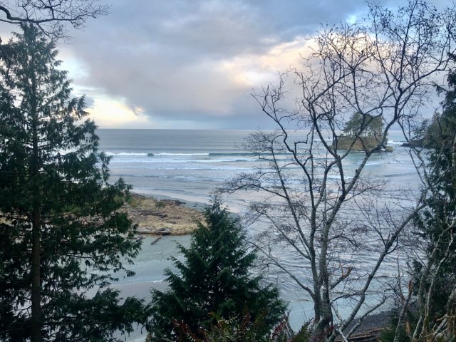
That morning we set off on a 6.3-mile roundtrip cedar-boardwalk path to
the Cape Alava beach. The trail cut through a dense forest of typically lush but aggressive OP vegetation. We were awed by the work required to prevent the dense flora from eating the trail.

Hikers have options: a round-trip to the beach and back in 6.3 miles, or a 9.4-mile triangular route beginning with the boardwalk trail we hiked, then a left turn along the beach past petroglyphs, then another left onto a trail that intersects the boardwalk near the trailhead. 

We arrived at Cape Alava in time for lunch and leisurely enjoyment. Had we decided on the 9.4-mile option, we would have been rushing. I'd love to see the petroglyphs and the alternate trail back. Maybe next time.

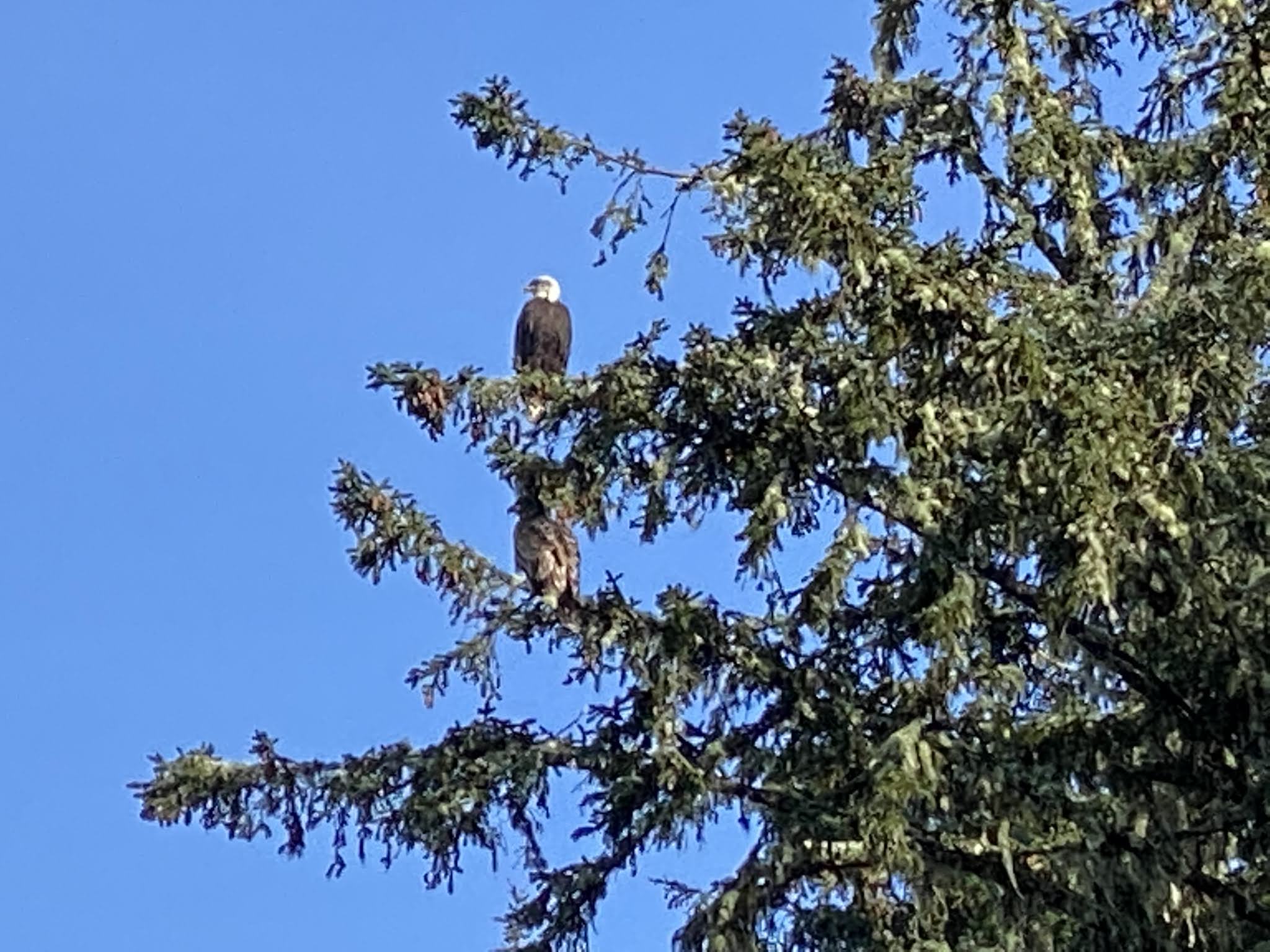
As it was, we had time to obverse dozens of bald eagles and enjoy the
solitude, sounds, and scents of a pristine wilderness beach.
 Then on to the next great place,  Rialto Beach


RIALTO BEACH 

I've seen a lot of ocean beaches, but Rialto takes the cake for drama. Colossal Pacific Ocean waves crash onto a steep beach, which is stacked high with huge logs, more logs than we've seen on any beach anywhere.

Chelsea and Chris had visited Rialto Beach a few weeks earlier at high tide when behemoth winter waves broke onto the logs, causing them to float and crash with enormous power and racket. I wish we could have witnessed that show, but what we observed was also awe-inspiring.  

However, if you're looking for accessibility, Rialto is not good; one must first navigate the logs to walk along the beach.

Chris shot this photo of Chelsea on an earlier trip.

 PK and I on Rialto Beach in our not-meant-to-be-matching jackets and fleece-lined trousers. Chilly! The surf had calmed since the previous day.

Seastacks framed by a beached log

The rocky beach looks bland, but colorful rocks hide there.

We hung out atop a beach log and enjoyed smoked salmon, crackers, and cheese and shared a bit of wine as we watched the sky darken - not really a sunset. When we arrived at the Mora Campground just a few miles up the road, it was dark— early February kind of conditions. A light but persistent rain set in, and we made quick work of finishing a simple dinner.

BOGACHIEL RAINFOREST TRAIL 

Light rain continued the next morning, our last day on the OP. We discussed our options: get an early start home along Highway 101, which veers away from the ocean for much of the way to the Oregon border. Or hike in the rain with Chris and Chelsea on one of the national park's rainforest trails. And then start the drive south.

Hmmm. Not much of a decision. Of course, we did the hike. 

The trail follows the Bogachiel River, one of the 19 wild rivers Chris is documenting, source-to-sea, in his kayak. (More about his project below.) 

We walked for 90 minutes or so before taking a loop back to the start. The muddy trail continued along the river, likely crossing more streams with log bridges, some with handrails, some without—Chris photo credit. 

Fungi flourishing in the rainforest.

Chartreuse is a dominant rainforest hue. 

Time to say goodbye along the Bogachiel River, one of the 19 Chris is documenting in the name of conservation. Chelsea photo credit.


MORE ABOUT CHRIS AND CHELSEA 

Chris has been a professional kayaker since 2009 when Eddie Bauer offered his first sponsorship. He is also a  professional photographer and a filmmaker, writer, and conservationist. His current project: Explore and document the OP's 19 wild rivers, source to sea, supporting current proposed Washington state legislation to protect them under the national Wild and Scenic Rivers Act. (As of this writing, the House of Representatives has passed the bill, which has moved on to the Senate.)

Facebook post

One of the 19 OP rivers being proposed for protection under the
 Wild and Scenic Rivers Act. 

If you'd like to "see more," follow Chris on Facebook or Instagram

                                                            ------

A brilliant student and
 endlessly curious.

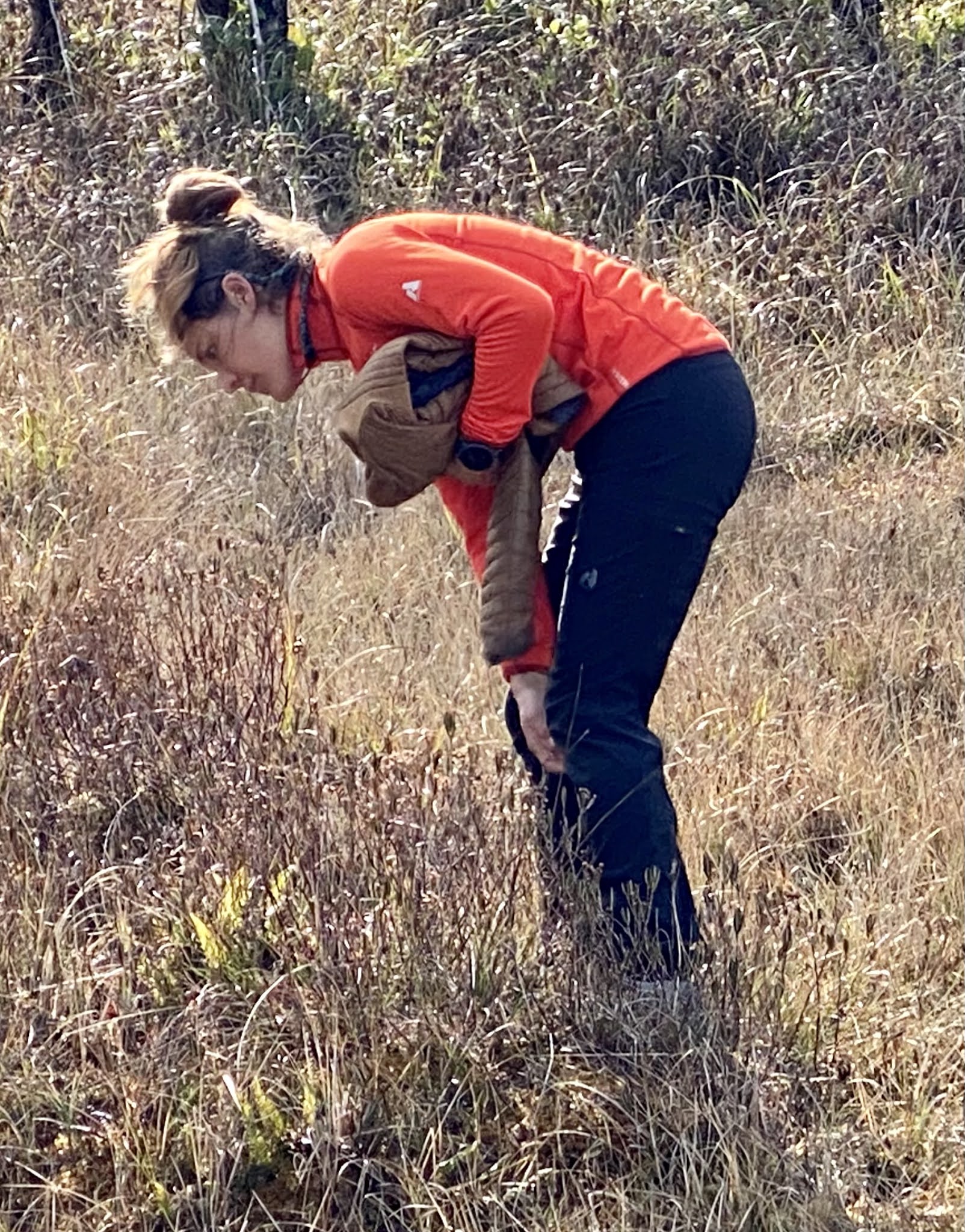
Chelsea Behymer is a determined Oregon State University Ph.D. candidate working on her dissertation and looking forward to her new seasonal job in Port Angeles. She'll guide mountain biking, canoeing paddleboarding adventures. Chelsea was a cruise ship naturalist during vacations throughout her college career, most recently with Lindblad Expeditions-National Geographic. In this photo, she's searching for wild cranberries in a rainforest meadow near Ozette Lake.


EARLIER POSTS  

Around the Horn 2018 with Chris and Chelsea - one of our best-ever  adventures 

Hoh Rainforest 2016 OP trip 

Tuesday, May 19, 2020

Living in Time of Pandemic Better With Gardening


Home and garden in July 2012. We've painted the house since then and stricken down the aggressive hop plant in the middle, but we expect our pandemic garden to look something like this.  


PK and I have inhabited the same 3.5 acres in Southern Oregon's Rogue Valley since the mid-1970s. That would be around 45 years, most of them as tillers of the soil. Never did the idea of experiencing a historic pandemic occur to me—to us—nor did we consider that gardening might someday become a smart survival strategy.

We may be headed in that direction now. We're not among the "survivalists" who migrated to Southern Oregon in the 1970s about the same time we did. The survivalists believed Southern Oregon was the safest place to escape radiation fallout should a nuclear war break out. 

Us? We landed in this spot serendipitously. No plan. No destination. Blown by the wind. But damn. When we hit the land it hooked us. Well, the land and having a baby. 

Remember those days? Hippies, including us, and many others, migrated to the rural West, sparking cultural clashes but ultimately melding with the locals to cultivate new lives in the new-to-us territory.

Now that a pandemic is poisoning the planet and rural lifestyles including small towns, farms and ranches, open spaces and wilderness all around must be looking pretty dang fine to people stuck in cities. If unemployed and anxious urban dwellers could swing it, my guess is that many would choose to relocate to where social distancing comes with the territory and a well-established gardening culture is in place.
Our neighborhood a mile outside the town of Rogue River shot from a mountain trail on the other side of the actual Rogue River. Our 3.5 acres is there someplace on the right.

We can't know for sure what'll happen next. But gardening benefits include that you can pretty much predict your food future and also your health, provided you eat fresh whatever you can, and preserve the rest. (We give away a lot of produce.)


A late summer harvest but where are the tomatoes?

Not that we've slipped into survival mode, but considering that Stephen King-like nightmares have disturbed my sleep through the years, I don't discount the possibility that our current globally shared shitty situation could devolve into pandemic pandemonium.

Yes. Rainbows over our garden. 

Back to the land.  Although I paint a rosy picture, usually, it is sad but true that PK and I have had an on/off-love/hate relationship with gardening for decades. Seeding, weeding, shoveling, spading, tilling, planting, fertilizing, watering, harvesting, and food preservation required by the big beautiful time-sucking rectangle in our backyard has been as much of a chore as it has been a cause for celebration.

And that's not even taking into consideration that when we bought the property, it was an orchard with 300+ apple trees! Now that was work! Most of which PK took on.

Most of the original apple trees were cleared to make pasture. We still have about a dozen producing trees, including this one which was bursting with blooms in April and is now loaded with fruit. For the first time in several years,  PK is tending the trees so we have organic apples to make sauce and butter and share with friends and neighbors. 


In fact, after excessive toiling with yet another too-much-of-everything garden in 2019, we determined to throw in the spade and skip the whole cultivation thing in 2020. No garden for us this year!

Instead, we decided to elongate the run of travel we've relished during the past decade. We'd been plotting a cross-country road trip in our sweet and spiffy Sprinter van. We'd roughed out a 3-4-month ramble that included music festivals, visits with family in Minnesota and New Jersey, a jaunt up to Newfoundland, and, as a grand finale, a flight across the pond for a European fall bicycle trip.

Of course, this trip is not going to happen. For sure not the flying-to-Europe part. I risk embarrassing myself even mentioning how the pandemic has upset our privileged lives of travel when so many are losing so much. We are fortunate and grateful to have choices.

We've chosen to switch gears. There's no ambivalence. Staying home is good, even if it's forced. Gardening is great, something that feels right and full of purpose. We never lack things to do. Days fly by. It's a privilege to have fertile land that we've worked through the decades, that rewards us with beauty and bounty, birds, and bees. Benevolence.


Cosmos volunteers return every year. Bees love them. Me too.

It's raining today but my gardening gusto hasn't dampened. Work-wise, springtime is almost as intense as the harvest season, but I'm glad to be out there digging in the dirt, inhaling the sweet scent of the soil that has been worked by PK and me innumerable times since 1974.


Can it be that I am finally rooted? I guess so.
Me with everything needed for spring planting in Oregon: a new pair of gardening gloves, a piece of dense foam for the knees, a raincoat, and a belief that ...
every little thing's gonna be all right. Bob Marley

Addendum

Oddly enough, I was primed for pandemic gardening during an intense volunteer trip to Guatemala in February. There I was inspired, even moved, by the extensive organic gardening, and other tasks, accomplished by indigenous Guatemalans, many of them teenagers at a remote mountaintop school named Maya Jaguar.* A post about my time there is in the works.

A master gardener, Pascual, oversees the school's
 organic gardening programs.

*The school is one of several efforts by the nonprofit Adopt-A-Village in Guatemala to lift Mayan youth from poverty and malnutrition through life-changing education. Graduates earn three certificates, one for completing academic studies, another for computer science proficiency, and a third for demonstrating competence at all phases of organic gardening. I love what I saw there. 


PREVIOUS GARDENING POSTS

Bye-bye garden, hello fun! 
A new take on marinara plus gardening ambivalence
Mid-June garden is messy but good!

Wednesday, January 22, 2020

How to do Machu Picchu and more


Dear Readers, Thanks for stopping by. I am a sporadic blogger and I appreciate your sticking with me. We've recently returned from five weeks in Peru and Colombia. Too many stories! But I will start with one of the best — Machu Picchu. Got a few minutes? 


A view from inside the citadel showing a small part of Machu Picchu...

... and a view from atop Machu Picchu Mountain, which we managed to climb. 

The truth is I didn't want to go to Machu Pichu. And neither did PK. Almost everybody has seen the iconic Machu Pichu photos, right? How much better can the place be in real-time?

A whole lot better, it turns out — it is among my most inspiring travel experiences ever.

Thanks to Steve Lambros, one of our two travel partners, for insisting that If we're going to Peru, I'm going to Machu Picchu! And so did we all. 

Our travel buddies Steve Lambros, Laurie Gerloff
on the train to Aguas Calientes/Machu Picchu.
During our trip planning, we learned about Machu Picchu's infamous crowds.  A World Heritage site, Machu Picchu is the most visited tourist destination in South America, and also at the top of the list for most beautiful places on the entire continent.  Guide books warn to order tickets far in advance and plan strategically to avoid hordes during high season.


Fortunately, we traveled to Peru during the low season, which often means rain. We got lucky. No rain and only a small crowd at Machu Picchu around 8:30 a.m., Dec. 13, 2019. 
When to go? According to a tour company's brochure:
The best months are late March, APRIL, May, and September, OCTOBER, November. During these months, Machu Picchu and the hiking trails that lead to it tend to be less crowded and with relatively good weather.
Note that June, July, and August - peak season with tons of tourists - are not recommended, and neither are December, January, and February - rainy season. 

Had it been raining on our Machu Picchu day, we would have been stuck with it as our arrangements had been made well in advance.

The thing is, you don't just say, on a lark, "Oh! It's a beautiful day! Let's go to Machu Picchu!" And there you are, dropped off at the gate. You can't take a direct flight, or direct anything, to Machu Picchu except for the short bus ride from Aguas Calientes that does stop at the gate. At the very least, once in Peru, a train and a bus are involved, and for hardy souls, two or four days of hiking the Inca Trail.

Machu Picchu tourists most often must find their way from Cusco, and that journey is worth noting. Machu Picchu is part of the storied Sacred Valley, as is the ancient city of Ollantaytambo, where tourists hop on a train to get to the most famous of all Inca ruins.


The Ollantaytambo train station is a marvel of efficiency with two final destinations: Aguas Calientes, a gateway to Machu Picchu, or, going the other direction, Cusco.
We hired a van to tote us 45 miles from Cusco to Ollantaytambo, in itself a tourist destination. Even without Machu Picchu being an hour and a half up the train tracks, this town's own grand archeological site and the ancient city's Inca-era grid of cobblestone streets and Inca-style walls and buildings would still draw and awe crowds.
This is the door to someone's home. See the modern 422 address? The larger smooth stones were likely placed by the Incas. The smaller stones held together with mortar were likely not. 
Our Machu Picchu guide said that visiting during the rainy season is
advantageous because one can observe the clever drainage system.
Stone gutters go for blocks uncovered, then disappear and reappear all 

the way to the mighty Urubamba River. 
We scored a great hotel with a balcony overlooking the scene pictured below. Altogether, we spent nearly a week in Ollantaytambo, and it took that long to figure out how to pronounce the name. 


The Ollantaytambo Archeological Park as viewed from across the valley. This site, the town itself, and Machu Picchu are all part of Peru's incredible Sacred Valley.
Typical indigenous dress and a typical tourist look.

Next, we caught the train to Aguas Calientes, a 1.5-hour ride away, and the next morning, a shuttle bus from Aguas Calientes to Machu Picchu.


This is the rip-roaring Urubamba River, which the train to Aguas Calientes follows the entire distance. It is a breathtaking river studded with Class 5 and 6 rapids and waterfalls. If you go, try to get a seat on the "river" side of the train. The river can be seen from numerous vantage points from Machu Picchu  Mountain. 

We stayed overnight in Aguas Calientes, just a short bus ride from Machu Picchu, so we could enter around 8 a.m. and begin climbing Machu Picchu Mountain by 9 a.m.


When you buy your MP ticket, you must select an entry time and a time to climb either MP Mountain or Huayna Picchu, if you choose to climb either. Huayna Picchu is the peak that appears behind the Inca City in the classic postcard photo of Machu Picchu.

But wait. What about Aguas Calientes? Everyone who visits Machu Picchu must pass through this town, which you can't drive to. The town has capitalized on its captive audience with remarkable public art and numerous hotels and restaurants.  If you visit Machu Picchu, staying the night before in Aguas Calientes makes good sense.

The hot springs for which the town is named are walking distance from
 the train station and downtown.

Back to Machu Picchu Mountain - The Climb Begins

We registered at the trailhead soon after 8 a.m. and started up after we decided to climb first, tour the citadel later. Four hours is the average time required to get up and down the mountain.

We began at 8,000 feet elevation and ended at 10,042 ft. after 1.5 miles. Whew! Fortunately, we were acclimated from having been at high elevation for several days. But still. We were huffing and puffing all the way.

The trail is advertised as being suitable for older people and children. We didn't see any children, and we were by far the oldest people. In all, we may have seen 20 others during our four hours on the trail. Most appeared to be in their 20s or 30s.  It is so weird to always be among the oldest people. We're grateful to be ambulatory and even, dare I say, fit.


Yes, the trail is super steep and rocky.

Every now and then, a person must stop and rest.
Huayna Picchu, the other mountain trail, is shorter and steeper but requires less time. However, people with vertigo or fear of heights were cautioned, and children under 12 are not allowed.

Although the Machu Picchu Mountain trail was in great condition, it was a series of steep rock steps of varying heights. 

Climbing the mountain required eager lungs, a stout willing heart, stalwart legs, bulletproof knees, and a clear brain focused on the task at hand, not straying toward sanity issues. 

So beautiful. So steep. Don't fall.

PK and I were grateful for the steep hills we'd forced ourselves to hike near our Oregon home in preparation. Little did we know at Machu Picchu that the MP Mountain was easy compared with another hike coming at us in a few weeks. Worst hike ever. Later. 


Not exactly the view Steve was hoping for when he reached the top of Machu Picchu Mountain, but the mists disappeared quickly.

A few moments later....clouds are on their way out. So amazing.

I love this photo of Laurie taking her last few steps to the summit

It almost hurts to take in all this beauty. A view from the mountain trail


                                     What goes up must come down.
Laurie always uses a hiking pole. Me too. 
Descending was almost as challenging as climbing. I would have been helpless without a hiking pole. Yet hiking poles were not allowed except for "older people." (See below all the objects and behaviors that are forbidden.) I passed a young woman on the descent who was clinging to her partner, covetous of my stick. The reason for the rule? Hiking sticks with metal tips may damage features of the ruins. Rubber-tipped sticks are permitted for older people. We'll take it.


Every view change is gasp-worthy.  It isn't just the citadel, but the river and the mountains. If you can go, do.

Machu Picchu Rules

I love most of the Machu Pichu regulations. My absolute fave is that selfie sticks are not allowed. I loathe selfie sticks and their tendency to create self-absorbed people. I can't count the times during the past few years of travel that selfie-stick-users have ruined otherwise fabulous scenery. They're so oblivious. Who could possibly be interested in their photos when their faces are front and center in every single one?

More Machu Picchu rules, and the entire list:
  • No general tumult. (The actual word used.) 
  • No running or jumping
  • No climbing or leaning on features.
  • No weapons
  • No tripods. This is a tough one, but tripods take a lot of space and time when both are limited.
  • No high heels. Duh.
  • No obscene acts inappropriate in a public place and that threaten morals and good manners such as undressing, disguising, lying down, or running. They're really against running.


Our guide, Fran, was excited telling us the Machu Picchu story.

Seeing Machu Picchu with a Guide - It's a Rule
If you want to explore this stunning and surprising place, you must hire a guide. We did not need a guide to climb the mountain, however.

Numerous accredited guides hang out near the entry. We happily paid $20 a person for a couple hours of guide services, then provided a generous tip because having a guide increases comprehension and enjoyment immeasurably. Plus it undoubtedly saves the site from people who'd love to chip off chunks of Inca genius.  Evidence of genius is everywhere at Machu Picchu.

The Incas were dialed into the stars, earth, rivers and all of nature. Their astronomical knowledge, agricultural skills, and engineering expertise continue to wow visitors and scientists. 
This wall seems ordinary, right? It is ordinary in Machu Pichu and other Inca ruins, but not elsewhere. Each rock is polished and shaped to fit perfectly with surrounding rocks. A credit card isn't thin enough to slip between the junctures. Even more amazing, the citadel withstood a 6.5 earthquake in the mid-1400s as described in this National Geographic article. Also, a great deal of engineering is in the foundation which extends deep below ground.
By contrast, our guide said, this wall was erected as part of restoration sometime after Machu Pichu was "discovered"  in 1911 by a Yale archeologist, Hiram Bigham. You could put all your credit cards in the cracks and never see them again.

What the heck is this? Note that the small rock "column" remains after the stone it was carved from has mostly disappeared. But why? Our guide couldn't wait to tell us.


The detail carved into rocks on either side of a door anchored the gate. This is just one little tiny thing in a vast outdoor museum of wonders.

I could go on about the Incas, but instead, I will leave you with images of beautiful things that renew each season.

FLOWERS ALONG THE
MACHU PICCHU MOUNTAIN TRAIL